U.S. Department of State

ORION

The real-time common operating picture for inter-agency Task Forces and Crisis Management

Just-in-time data logistics for crisis management

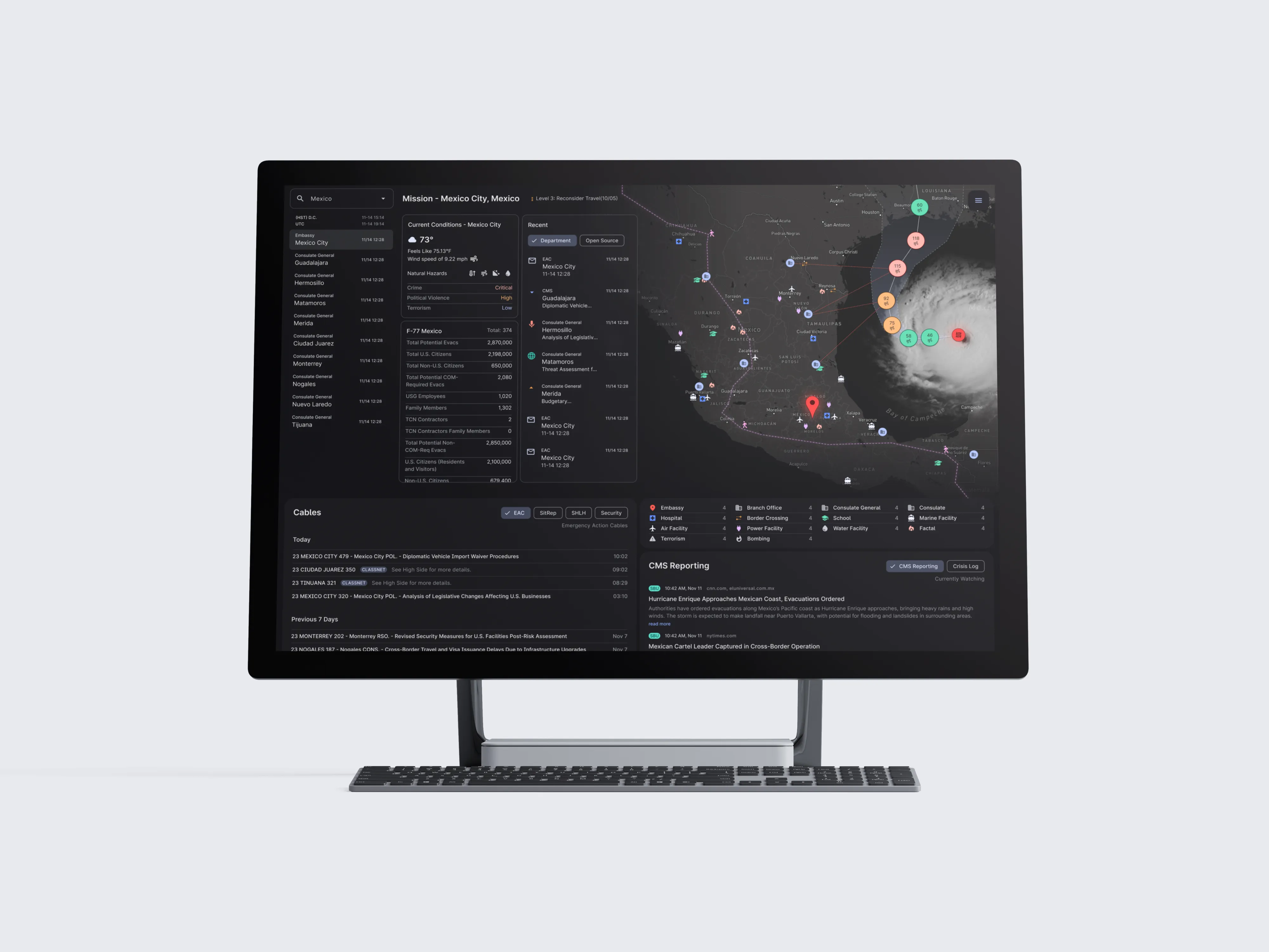
ORION (Ops Response Interagency Operations Network) is a common operating picture application developed for Crisis Management Officers in the Executive Secretariat Operations Center. ORION pulls real-time intelligence from swaths of internal and public sources, threading together scattered data into an array of coherent situational awareness views.

A computer monitor displaying a detailed mission dashboard for Mexico City, including current weather conditions, a satellite map with hurricane tracking, and facility markers.

ORION is a unified technology platform that allows the Operations Center to facilitate information sharing, better enable proactive risk assessment, and improve crisis response.

Deputy Secretary Verma

ORION is a unified technology platform that allows the Operations Center to facilitate information sharing, better enable proactive risk assessment, and improve crisis response.

Deputy Secretary Verma

ORION is a unified technology platform that allows the Operations Center to facilitate information sharing, better enable proactive risk assessment, and improve crisis response.

Deputy Secretary Verma

A satellite view of Earth at night, showing illuminated city lights across continents, with a portion of the planet's curve visible.

Getting our arms around a planet-sized problem

How do you keep your thumb on the pulse of an overseas US post?

Supplies, equipment and facilities, personnel data, political climate, local news, nearby events, flood risk, CDC alerts, and even tracking comms disruption from geomagnetic solar storms are only a fraction of the factors used to gauge a post’s operational health and safety. We needed enable a handful of staff to monitor, anticipate, and react to conditions at over 200 US posts scattered across all corners of the planet.

Culling noise and breaking down barriers

ORION is about two things. First, get a lot of good data. Second, show as little of it as we possibly can.

Of course there’s more to it, but framing our approach through that lens helped us build air-tight information feeds and data visualizations, tuned to precision through rapid iteration with our core users to ensure they could always see exactly what they needed at exactly the right time.

This user-centric strategy was a compounding success, helping Ops broker successful interagency data-sharing agreements in all discussions that included an ORION demonstration, strengthening cross-agency collaboration.

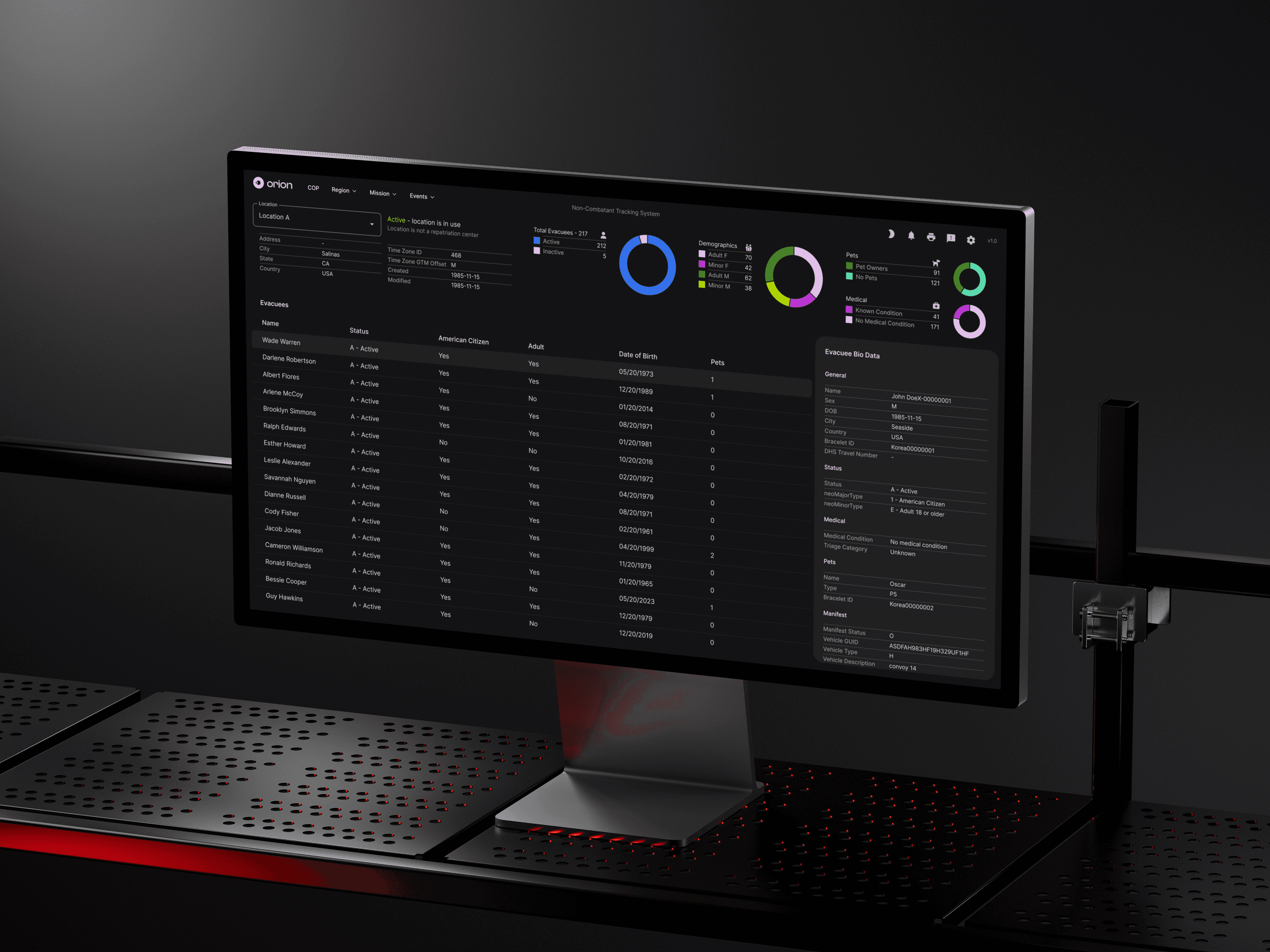
A computer monitor displaying a non-combatant tracking system dashboard with demographic charts, status details, and a list of individuals.

Let's build something great.

Get in touch

NAICS

541430

541512

541611

541910

541511

© 2024 Manmade Creative, Inc.

NAICS

541430

541512

541611

541910

541511

© 2024 Manmade Creative, Inc.

NAICS

541430

541512

541611

541910

541511

© 2024 Manmade Creative, Inc.